Beautiful Laya Ghasa Trekking

19 Days
Bhutan
2
Moderate
  • Trip Code: Beautiful Laya Ghasa Trekking
  • Trip Type: Trekking
  • Max. Altitude: 5005 m
  • Travel Mode: Air/Coaches

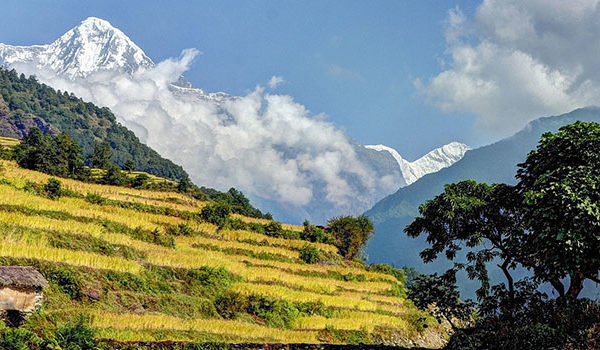
This trek route offers a great variety of trekking conditions, from picturesque farmland and forests to alpine pastureland and high passes.

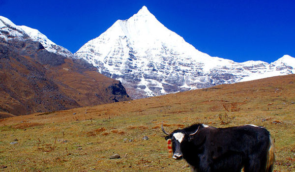
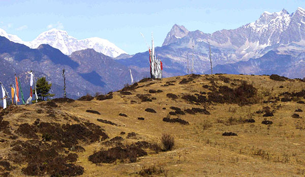
Spectacular campsites, beneath some of Bhutan’s most impressive peaks, of which the most notable are Mount Chomolhari and Mount Jichu Drake, are also the features of this trekking route. Numerous isolated Dzongs and scattered settlements, including the outlandish village of Laya, provide a great deal of cultural interest enroute.

Wildlife such as the blue sheep, marmots, musk deer and the national animal, the Takin, can be seen. One should also not rule out the possibility of the rare sighting of a snow leopard, great Himalayan bear or even the yeti.

Overview
Trip Code Beautiful Laya Ghasa Trekking
Trip Duration 19 Days
Trip Type Trekking
Trip Grade Moderate
Min Group Size 2
Max Altitude 5005 m
Trip Start Paro
Trip End Paro
Best Season Mar-May & Sep-Nov
Transportaion Air/Coaches
Meals All meals
Acommodation Lodges/Tented Camp
Itinerary

Arrival in Paro & transfer to Hotel. The Paro valley has kept its bucolic nature in spite of the airport and the existence of development projects. Fields, brown or green depending on the season, cover most of the valley floor, while hamlets and isolated farms dot the countryside. The houses of Paro valley are considered among the most beautiful in the country. Paro is believed to be one of the first valleys to have received the imprint of Buddhism.
Afternoon: Visit the National Museum (Ta-Dzong). Once the watchtower for the Rinpung Dzong, it was converted into the National Museum in 1968. The museum stands on a promontory overlooking the Paro valley in all its glory.
Visit the Paro Rinpung Dzong. A flagstone path rises gradually from a beautiful wooden bridge with shingle roofing and abutted by two guardhouses, to the Dzong. Today, the Dzong is the seat of the district administration as well as the home for the monastic school. The central tower (Utse) of the Dzong, with its superb woodwork, is one of the most beautiful in the nation. The Dzong was built in 1645 A.D. Check in to the Hotel.

Morning drive to Drugyel Dzong (a ruined fortress 16 km away from Paro town). The Dzong, although in ruins, holds great historical significance. It was from this fortress that the Bhutanese repelled many Tibetan invasions. The name means the victorious Bhutanese. This spot offers a magnificent vista of Mount Chomolhari, “Mountain of Goddess” (7329 m).
Visit a typical Bhutanese farmhouse on the way back.
A short distance south of the road is Kyichu Lhakhang. This temple is said to have been built in 659 by King Songtsen Gampo of Tibet. It holds down the left foot of an ogress whose body is so large that it covers Bhutan and most of eastern Tibet. Overnight at Thimphu.

First day of the trek follows Paro Chhu valley climbing up the ridges. The actual trek starts from Drukgyel Dzong at 2580 m. From here you look back to see how dzong was positioned. After covering a short distance you will find the settlement of Chang Zampa. A further walk takes the settlement of Mitshi Zampa, finding little shops and hotels. The valley widens and you will reach the army post of Gunyitsawa at 2810 m, there is also a primary school and few shops..

The trek continues at the side of Pa chhu through conifers and rhododendron coming across Jigme Dorji Wangchuck National Park. By making gentle climbs on the rock through oak, crossing several streams come across Phari Dzong of Tibet. Then climb a little ridge, cross the Paro Chhu on a wooden bridge. Finally come across Thangthangka at 3630 m, where Bhutanese style houses are there.

At night Jumolhariis covered with clouds, but be sure to view early in the morning. Jumolhari appears behind the ridge. Less than an hour from camp at 3730 m is an army post. A short climb leads to small chorten finding yak country. Making a further climb come across Takethang, a cluster of stone houses on a plateau at 3940 m.

Here is the best viewpoint; you won’t get better any better than here. The ridge is endless, after an hour of climb you can view Jichu drake (6989 m) and Jumolhari. If you like to see much of the country better to trek from Nyile La to Lingzh

If you have problems with altitude don’t go to Lingzhi. Ten minutes beyond the camp, you will start to find settlements. This is the last settlement in the valley and is an extremely isolated place. From this place you can also view Jichu Drake. Passing by you can see Jumolharipeak. Then it comes across Nyile La at 4890 m. Dropping down to the valley at 4450 m and stopping for lunch here. Trekking further away, you will see Mt. Jumolharipeak in its full bloom; you will reach Chelela Pass, and descend down to reach Lingzhi.

Walk down on the wooden bridge below the Lingzhi Dzong, along one house, which is part of Lingzhi village. Coming closer to the dzong make a close look by climbing to the dzong at 4220 m. After an hour from coming to ridges of prayer flags and further, settlement of Goyak at 3870m. Leaving Goyak come across Chebisa village at 3880 m.

The route climbs a ridge passing a few houses, where blue sheeps are living. Also you will have a chance to see vultures and Himalayan griffons flying overhead. Further climb reaches Gombu La (4440 m). There is little climb, you can reach yak herders huts and then over the side of the valley and down to Shakshepasa at 3980 m and helipad, marked by big H. Then drop down to something and camp by the river at Shakshepasa..

Climb up the valley, you will view show cap of Kang Bum (6526 m). Making two hours climb come across Jhari La (4747 m), from here you can see Sincha La. The big show cap in the north is 6840 m Gangchhenta (Great Tiger mountain), as well Tserim Kang and top of Jumolhari visible in clear weather. The camp by the river is called Tsheri Jathang, where Takin is available and declared as Tankin Sanctuary. Climb up and reach Robluthang at 4160 m..

Here is Sinche La; the last and highest pass on the trek. Above the camp, is a little stone house where a Laya woman lives. It’s high altitude and will slow down very much. Passing through the paryer flags is a Sinche La (5005 m). Coming down to Kango Chhu and continue to Limithang camp, there is huge glacial lake at the foot of the valley. Now crossing the Kango Chhu at 4260 m and reach to Limithang at 4140 m. You can view peak of Gangchhenta tower from a distance.

Walk for 20 minutes and enter to deep forest. Drop down to the river valley at 3800 m and walk through heavily wooded forest. Coming ahead you will find a stone house and paddy field and monastery up above. From the west of village you and view Gangchhenta and some part of Masang Gang, 7165 m. In the village center is a community school and hospital. Camping below school at 3840 m.

Day Halt at Laya.

The trail end at Khonying stupa, passing to another stupa at Jaje-kha. Cross the wooden bridge river arrive at army camp and check post near to that, where the guide register the name so trekkers. The peak of Masang Gang (7165 m) is barely visible. The route follows down to Mo Chhu down stream all the way to Punakha. Lots of up and down climb to Kohi Lapcha at 3300 m. Then dropping down to large stream is Koina (3050 m). Camping here is unpleasent.

Cross the bridge at Koina and start up hill through muddy trail to Bari La (3900 m). The route start down, through bamboo forest to stream. At 3080 m see Gasa Dzong and drop the route to large stream at 2780 m and pass by four chortens on the ridge at 2810 m. The trail passes through Jigme Dorji National Park and leads to Dzong, School. You can camp near town or climb up hill to hot spring.

Trail towards south passing through few house and mani wall; after sometime look back for a good view of the dzong. Cross the suspension bridge river at 2360 m, climb up the hill where you can view hot spring and Laya. The trail climbs up and arrives at four houses of gun and climb to stupa. Making short walk, you will reach to Damji at 2430 m.

Trek ends and drive to Punakha. Drive to Wangduephodrang for sightseeing & drive to Thimphu. The trail climb to southern part of village and after long descent you will cross wooden bridge at 1960 m, making up and down trail. You may encounter rhese monkeys playing alongside the river as well Taking in this area. After long walk cross high suspension bridge over the Chaka Lumbi Chhu. A short walk along the roadbed to the stream, finally to Tashithang and vehicle will be waiting for you to take to Punakha.

Thimphu lies in a wooded valley, sprawling up a hillside on the West Bank of the Thimphu Chhu [Chhu means River]. Thimphu is unlike any other world capital. Small and secluded the city is quiet and there are never the traffic jams familiar in other Asian Capitals. It is often said that Thimphu is the only world capital without traffic lights. Thimphu’s main shopping street is a delight not so much for what you can buy there, but for the picturesqueness of the architecture and national costume. Beautiful weaves in wool, silk and cotton, basketwork, silver jewellery, thankas and other traditional crafts of the Kingdom are available in various Handicraft Emporiums.
Morning Visit the Memorial Chorten, a huge Stupa built in memory of the third King who reigned from 1952-1972. Visit the National Library where ancient manuscripts are preserved. Visit the Painting School where traditional art is still preserved. Artists are taught to paint Thankas here (sacred Buddhist scroll). Visit the Handicrafts Emporium where one can buy Bhutanese textiles and other arts and crafts. Visit the Weekend market where vendors from throughout the region arrive on Friday afternoon and remain until Sunday. You will find indigenous goods, handicrafts, locally produced goods, etc. Afternoon: Visit Semtokha Dzong.
This is the oldest fortress in Bhutan, built in 1629 A.D. by Shabdrung Ngawang Namgyal. It also houses the largest monastic schools in the country. Visit Tashichho Dzong, the main secretariat building. It is from here that the King& other prominent civil servants run the country. The Head Abbot and the central monastic body also reside here during the summer. Visit Pangri Zampa Monastery, situated just beyond Dechencholing Palace (5 km from Thimphu). This temple was the first residence of Shabdrung Ngawang Narngyal when he arrived in Bhutan in 1616 A.D. Ngawang Chogyel, the great ancestor of the Shabdrung, built it during the first quarter of the 16th century.

Drive to Paro for departure.

Service Includes/Excludes

For the price please write us an email: info@nectravels.com

Trip Cost Include:

» Airport pickup and drop
» All accommodation
» All Meals (breakfast/Lunch/Dinner)
» All Transportation by car van/Bus/Coaster
» One English Speaking Guide
» Sightseeing Entry fee
» Bhutan Travel Permit
» Equipment: Trekking tents, Dining tent, Kitchen Tent, Toilet Tent, Table and chairs, Mattresses during the trekking
» All Food for trekking ( Breakfast, lunch, dinner) prepared by our cook
» Staff: 1 Trekking Guide, 1 Cook, 1 Kitchen & necessary porters
» All transportation by car/ van/ bus
» Trekking crews of insurance
» Trekking allowance, food allowance for trekking crews


Trip Cost Exclude:
» Airfare
» Bhutan Visa fee (USD 20.00)
» Tourism Development fund(TDF USD 10.00)
» Emergency Rescue evacuation
» Trekking Sleeping bag
» Personal expenses
» Tipping (Tips)
» Bar bills & beverage


Reviews

Write Review

Please rate*

Your email address will not be published. Required fields are marked *